

Over this past Thanksgiving weekend, Mr Metawitches and I took a day trip from Albuquerque down to the White Sands National Monument. The monument is adjacent to Alamogordo, NM and White Sands Missile Range, which will be familiar to history buffs as the location of the Trinity Site, where the first atomic blast in history took place in 1945. Metamaiden stayed home this time, to dye her galaxy hair in a new and exciting pattern.
We got off to an unfortunately late start, so we didn’t make any stops along the way this time. With sunset coming at 5:00 PM, the daylight goes quickly. It was a sunny day, and unseasonably warm, with a high in the mid-70s. We’d been planning to visit White Sands on this day for a couple of months, but many others were lured out by the beautiful weather. It was a crowded day at the park.
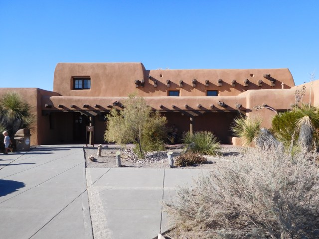
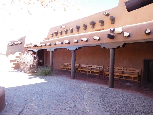
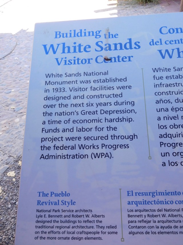
Once at the park, the first stop was a quick look around the Visitors Center. This is one of many national parks whose facilities were built by the Works Progress Administration during the Great Depression of the 1930s. All of these facilities that we’ve visited have been beautiful, and built with access to nature in mind. We’re so lucky to be able to enjoy stunning architecture and art at the same time as we take in nature’s wonders.
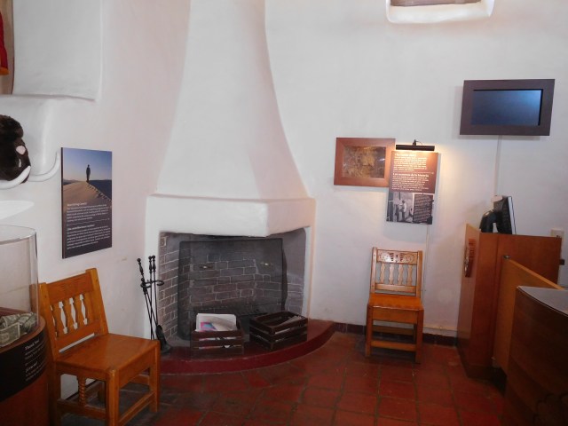
We took a fast walk through the complex, without even bothering to take more than a glance at the exhibits, since the place was mobbed and time was short. I was able to sneak in a few photos. The visitors center complex was designed in the Pueblo Revival style, and is designated a National Historic District.
Then it was on to the dunes! If you’ve never been to New Mexico, or the southwest, it’s important to know that most of the region is made up of red rocks, and sometimes tan rocks. But mostly red rocks. And red sand. Everywhere. Sightseeing in the southwest is largely a matter of looking at different shades of rocks in different forms and configurations. Don’t get me wrong, it’s all cool and I love it, but it’s a lot of rocks.
So, as you might have guessed, White Sands National Monument’s claim to fame is not the rocks, but the, ahem, white sand. Or, as Metamaiden put it, the teeny tiny rocks. Sometimes she’s no fun. The sand is very white. And there’s a lot of it.
Dunes Drive, the scenic road that takes visitors throughout the park, was also a WPA project during the Great Depression. It’s 8 miles long with a loop at the far end, making for a 16 mile round trip. The first 3 miles are paved, then it’s unpaved road the rest of the way, driving on hardpacked sand that has to be graded and plowed by park rangers, just as if it were snow.
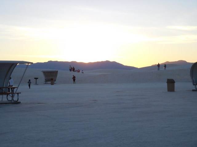
There are many pull outs, picnic areas, trails, and a boardwalk for visitors to use as they explore the park. Walking around the dunes is encouraged, as it’s impossible for regular trail boundaries to be maintained on blowing, shifting sand dunes! The visitors center rents sleds for sledding down steep dunes.
When we were there, nearly every steep slope, no matter how tall or short, had someone making a go of it with a sled. The more experienced sledders had figured out that the best places were the tall, steep banks, deep into the park, at stops like the Roadrunner and Yucca picnic areas. But everyone seemed to be having fun trying! Mr Metawitches is determined to give it a try himself the next time we’re there.
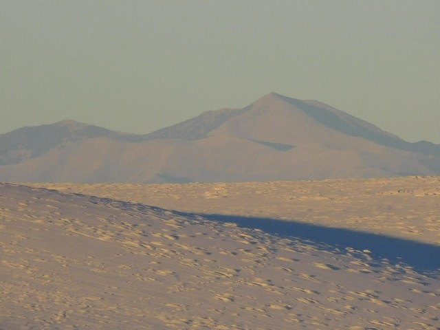
White Sands National Monument is in the Tularosa Basin, at the foot of the Andres Mountains, at the Northern end of the Chihuahuan Desert. The sand is made up of gypsum left behind by the Permian Sea millions of years ago. This is the largest gypsum dunefield in the world, covering 275 square miles.
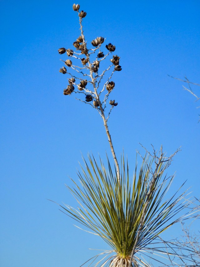
Because of their chemistry, the dunes stay wet even during droughts, holding the sand in place. The water becomes saltier in the center of the dunefield, meaning that there is very little life as you reach the Heart of the Sands. The outer parts of the dunefields host grasses, shrubs, small mammals, birds, insects, yucca, and many of the other species that have adapted to the Chihuahuan Desert.
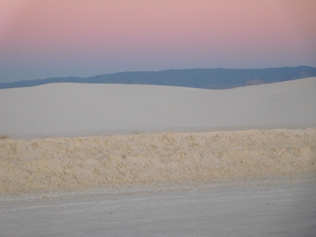
Dunes Drive takes visitors from the edge of the dunefield into the Heart of the Sands. The vegetation starts out as the typical desert scrub, then becomes more like beach or low grassland grasses and plants, grows sparser and sparser, until finally there is no vegetation, just huge white dunes.
At that point it looks for all the world like snow. It’s plowed up against the side of the road, and the piles form like snow piles. When it blows and drifts in light winds, it looks like loose, drifting snow. The sandy roads look like hard packed snow and ice. And there are people sledding in it.
My animal brain is easily disoriented. After spending 49 years in the northeast, with long snowy winters, I couldn’t convince the instinctive part of myself that it wasn’t snow once we got out to the deepest parts, where you can’t see anything else. I was continually tensing up, sure the car was going to wipe out on the ice!!
The real danger is wandering too far from any recognizable landmark, and getting stuck in what’s essentially a white out. When we were surrounded by tall dunes, I did lose my sense of direction a bit as well, since the sun was low in the sky by then. People have died here by getting lost in the dunes during hot weather, without enough water and salty snacks, and having no idea which way is the way back to safety.
But not on this day. When we were there, the picnic areas were filled with beach parties. There were large family groups, and one motorcycle gang, grilling and playing loud music. They were sledding for entertainment instead of swimming or playing frisbee. It was a riot.
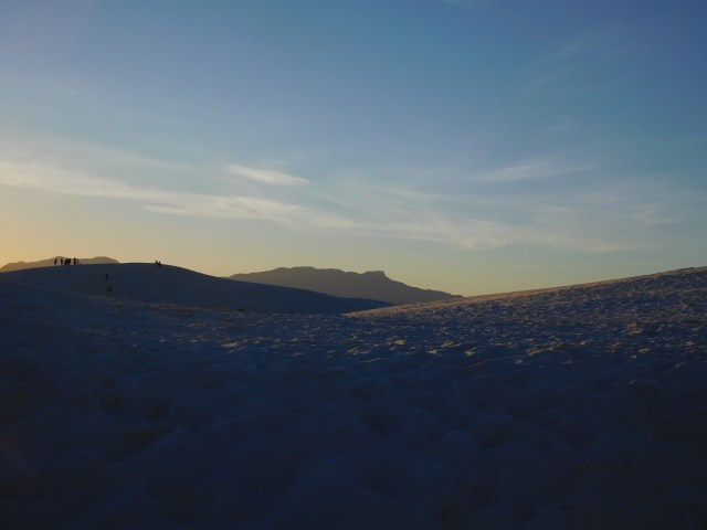
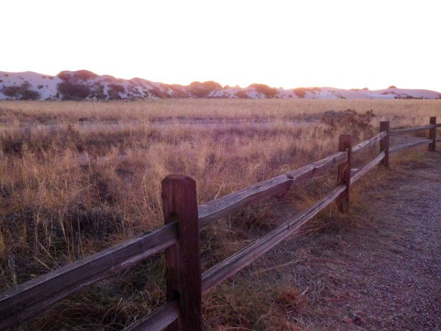
We walked part of the first trail, the Dune Life Nature Trail, and the boardwalk, then drove the rest of Dunes Drive, making stops to get out and look around. We stopped at the Yucca Picnic area to have a snack and wait for sunset, then watched the sun go down and the colors change. Experiencing sunset at national parks and monuments with interesting views is one of my favorite things to do.
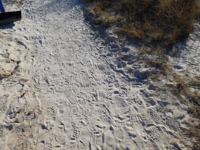
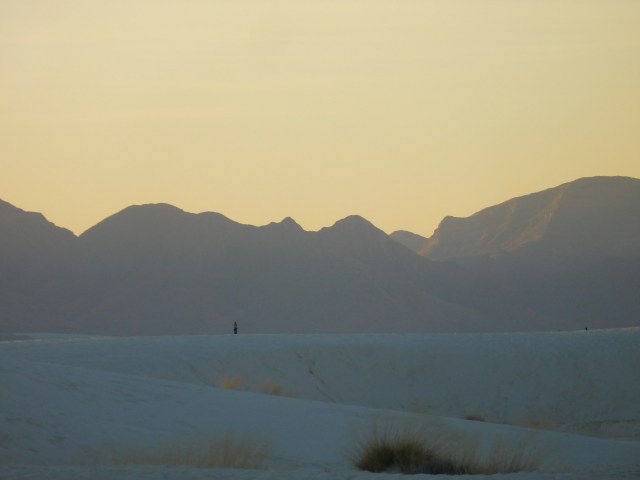
The Dune Life Nature Trail is fascinating for a first look at the sand, and for marveling at how species adapt to life in deep, loose sand that flows almost like water. There are some great views, both into the middle distance and far off. The photo at the top is from that trail. Watching the colors of the sand change in the Heart of the Sands at sunset was like being on another planet. I still have a hard time convincing my brain that it’s just plain old earthly white sand.
The drive from home to the park took us about 3.5 hours in each direction. White Sands is tucked in an out of the way valley, so much of the drive is through sparsely populated desert and mountains, plus the occasional small town. The Missile Range is still in active use, though not for radioactive test purposes, and the monument closes down for a few hours occasionally while missiles are tested nearby.
There are a few interesting features along the way to explore if one wanted to make it a longer trip, such as the Bosque del Apache National Wildlife Refuge (a protected section of the Rio Grande River ecosystem that provides a valuable refuge for migrating waterfowl), the Valley of Fires Recreation Area (adjacent to the Malpais Lava Flow), the Trinity Site (if you happen to be visiting the 1st Saturday in April or October) or Pistachioland, home of The World’s Largest Pistachio, which also has a vineyard and pistachio ranch. Sadly, we saw the pistachio from the road, but did not have time to stop. Next time, I will not be denied my road side kitsch fix!
The Visitors Center


The Dune Life Nature Trail


The Boardwalk


The Heart of the Sands, Sunset and Exit


This is such a beautiful place. I enjoyed visiting here 😊
LikeLiked by 1 person